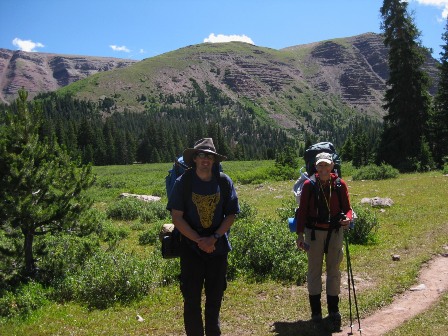
Kings Peak
This article was originally written for the Las Vegas Mountaineering Club web site. That is why it refers to people by name who my web site readers would have never heard of. Actually, my astute readers may recognize the name Joel, who attempted the Burrito Challenge, as I wrote about in my Sahara review.
For the benefit of my blog readers, gambling is not the only thing that interests me. I enjoy a challenging mountain to climb. A few years ago my friend Joel took it upon himself to climb the high point of all 50 states. He got me somewhat excited about a pared down goal. So, let the record show I have the less ambitious goal of trying to summit as many state high points as I can. However, I only count the western states, in particular anything including and west of the Rockies. I'll throw in Texas as well, as that has a respectable high point. Everything else in the central and eastern US is too easy to fuss with.
On this trip various members of the Mountaineers club did several climbs in Nevada, Idaho, and Utah over an 8-day trip. I didn't have time for the whole itinerary, so I flew to Salt Lake City towards the end of the trip to just do two peaks in Utah. The rest of this blog entry is my report on that portion of the trip. By the way, my short list of western states I have high-pointed are now California, Nevada, and Utah.
On August 6, I flew to Salt Lake City to join up with Joel and Justine en route to conquer Kings Peak and Gilbert Peak. After some Chinese food for dinner, we drove about three hours to the trailhead at Henry's Fork campground. While this journey started and ended in Utah, it necessitated driving through Wyoming, which was a state I was missing from my quest to visit all 50. 47 down, 3 to go. Joel and I made a wager whether or not a sign would indicate the state border crossing on the dirt road leading to the campground. Said sign was not definitively seen on the way in, but it was dark. Joel had the "no" but graciously allowed me another chance to look for it on the way back.
The first order of business was finding Harlan and Ali, who drove up separately from Vegas. It was totally dark and there were cars everywhere. Despite that, we luckily found them without difficulty. Ali's license plate reads ALIG8R, which is not only clever, but makes it easier to spot his vehicle. Joel and Justine were exhausted from a long day climbing Mt. Borah, and driving a very long distance, so we hastily set up our tents and called it a day.
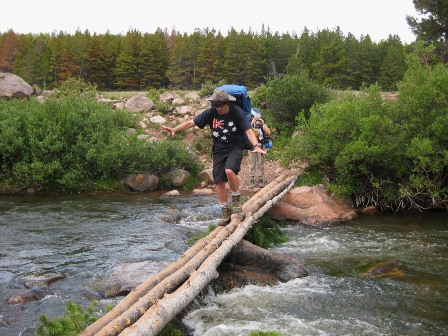
The following morning, we set off for our next camping spot by Dollar Lake. It was an easy day, traveling about eight miles with about a 1000' elevation gain. The trail starts out amongst tall pine trees and follows alongside Henry's Fork River. After about three miles, we came to the spot of a washed out bridge, where he had to cross the river. Somebody before us had tied three narrow logs together, which we braved crossing. Actually, I was probably the only one who was nervous about it. The rest of the group walked across it barely slowing down from their usual pace, as if it were a six foot wide sidewalk.
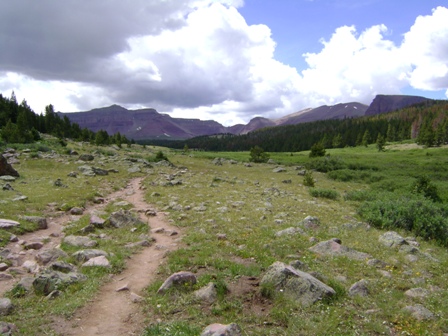
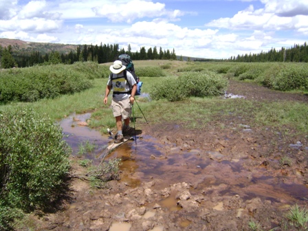
After the river crossing, the trail passed through some long, grassy drainages. Meanwhile, the mountains got larger, and the trees got smaller. This was the most scenic part of the hike, in my opinion. However, the cost of hiking through a drainage is that parts of it were so muddy my foot nearly came out of my boot as I tried to extract it from the mud. During the trek to Dollar Lake, we past at least 100 hikers coming the other way. Almost all looked like men in their early twenties, many bearing fishing poles. I was afraid the Dollar Lake area was going to be overcrowded with so much traffic on the trail.
After a pleasant and easy journey, we found Dollar Lake — which is not visible from the trail — and set up camp. We chose a nice spot in the woods near the lake. Despite all the foot traffic we crossed on the trail, the Dollar Lake area was surprisingly sparsely populated. There were only a few other groups near the lake, and a few others further out. This was on a Friday, so you would think more people would be traveling to the lake than from it. It was rather bizarre.
The rest of the day we took it easy as we tried to evade the numerous mosquitoes. It would have been nice to make a campfire, as some perfectly chopped wood was left right by a fire pit. Unfortunately, we were within 1000' feet of the lake, according to Joel, and a sign indicated campfires were prohibited within this radius of the lake, a rule our neighbors did not obey.
With an early start planned the next day, we went to sleep quite early. I still wasn't tired, so I spent some time with a book I had fortunately tucked in my pack. Normally I'm uptight about pack weight and don't allow such luxuries as a book, but am glad I made the exception. By the way, the book was I'm a Stranger Here Myself by Bill Bryson. Not as good as Bryson's best work, in my opinion, A Walk in the Woods, but still very funny and interesting.
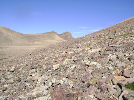
Saturday we got started early in an attempt to beat the usual afternoon storms Joel warned us about. We started out continuing southbound until the end of the drainage. During this time, I had a backpack malfunction. My left strap came loose from the old backpack I've been using for 25 years. Fortunately, the very well prepared Harlan had an extra shoelace that I used to remedy the problem of a lost rivet. Then we went up and over Gunsight Notch. After this point, there was a lovely valley directly separating us and Kings Peak. Did we walk across this nice level valley? No...somebody had to put up a bunch of cairns in the rocks along the edge of another peak on our right. We were fooled by these false cairns and spent about an hour scrambling over rocks unnecessarily.
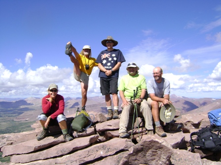
Eventually we approached the base of Kings Peak, which was much more of the same. Kings Peak itself is basically an enormous rock pile. The climbing is not especially challenging or dangerous, but it is tiring and redundant. At this point, there was no trail, so one could scramble up a million different ways. I think it took us a little longer than planned, but we eventually made it in fine shape. We took the ubiquitous summit photos but were deprived of the joy of signing a register because nobody could find one. If the reader of this is thinking of following our footsteps, please consider supplying one. Here are some facts about Kings Peak I got from peakbagger.com:
Kings Peak:
Highest Point in Utah.
Highest Point in the Uinta Range, which is noted as the only west to east mountain range in the country.
Elevation: 13,512 feet.
Latitude/Longitude: 40? 47' N; 110? 22' W
Distance from trailhead: 12 miles.
Elevation gain from trailhead: 4088 feet.
During the trip back, our party got separated climbing down the rock pile, but we regrouped at the bottom and walked back across the grassy valley this time. As we went back over Gunsight Notch, the afternoon storms set in and we walked in the midst of a mild hailstorm for a while. I should also add that several marmots and picas were spotted among the rocks that day.
We made it back to camp in the mid afternoon and had quite a bit of time to kill the rest of the day. Fortunately, Joel had the wisdom to bring a bottle of wine, which some of us, including me, enjoyed a great deal. After a few cups of wine, Ali didn't hold much back about his "buy high — sell higher" investing strategy. Meanwhile, Joel and I did what we often do when boredom sets in — betting on anything we could think of. The most fun wager was on whether or not Justine could name more than 7.5 nuts. She got six in no time, but it took quite a while to come up with two more. After almost an hour, she got her eighth nut, a cashew, and the over won (yeah for me!). Harlan occupied moments of boredom with singing, usually the Tomorrow song from 'Annie,' or random quotations. At one point, my nap was broken by a quote from Rene Descartes.
For meals this trip I harkened back to my college days, where I dined on Top Ramen and Macaroni & Cheese almost every night for three years. I never grew tired of them back then. However, my tastes must have become more discriminating (my mother would say pickier) over the years, because it seemed they didn't taste nearly as good as they used to. I envied everybody else who brought Mountain House meals. In all fairness, I used to add an egg to Top Ramen, and margarine to Macaroni & Cheese, which does make them taste better.
On Sunday, we again got an early start to conquer Gilbert Peak, which was just above our camp and only slightly lower in elevation than Kings Peak. After walking around Dollar Lake, it was a steep climb upward. Then we trekked along the top of a grassy plateau dotted with scattered rocks. The weather was gray and windy. Harlan said that part of the hike was very reminiscent of his recent trip to Scotland. From my memories of Braveheart, I had to agree it did seem like we were in the Scottish highlands.
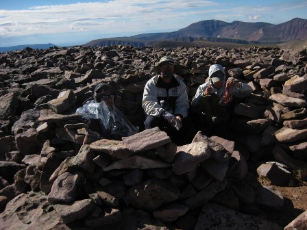
As we went across this little piece of Scotland, the wind got heavier and heavier. Eventually, we had to start scrambling up rocks again, much like the day before. Fortunately, the rocky parts alternated with grassy, more level parts. The higher we rose, the windier it got. When I finally reached the top, Harlan was already there, putting more layers onto a windbreak, which I was very happy to see. I'm not a good one at estimating wind speeds, but it felt like it did when I went skydiving two years ago. The consensus of the rest of the group was that the gusts were up to 50-60 mph. After we all reached summit, everyone but Harlan hunkered down in the windbreak to get a temporary relief from the wind. Harlan seemed not to be bothered at all, as he added more rocks to the wind shelter. During this time, the normally cheerful Justine proclaimed, with great emphasis, "This peak sucks!" It was so unlike her. In the few days I got to know her, seldom was heard a discouraging word from her.
Before I forget, here are some quick facts about Gilbert Peak.
Gilbert Peak:
Elevation: 13,442 feet.
Third Highest Peak in Utah.
Highest Point in Summit County, Utah.
Latitude/Longitude: 32.84000?N / 113.91?W.
Distance from Dollar Lake: About 3 miles.
After taking some quick summit photos in the fierce wind, we headed back down. When we reached the point somewhere near where we had scrambled up the steep face, there was disagreement about exactly the spot to descend. Harlan and Joel took the short and steep route directly back. Justine and I took a longer and more gradual descent, which we were unsure existed, but it did, and it was very pleasant. By the way, Ali didn't accompany us on Gilbert Peak, because he wasn't feeling well.
When we returned to camp, we had the option to spend the rest of the day there and hike out tomorrow, but that would have left us with a lot of time to kill and mosquitoes to fight, so we packed up and headed back down the trail. As we traveled, again we crossed at least 100 people hiking towards Dollar Lake. Again, where all these people go is a mystery to me. This could make for the plot of an episode of the Twilight Zone.
The hike out was pleasant and uneventful. Along the drive back to civilization, we passed a small vertical post saying "Wyoming," which was the first bet made, but the last to be resolved, fortunately my way! It was then a long drive back to Vegas. I was in the mood for pizza and beer, but since we all smelled really bad, we disgraced a Subway franchise in Heber City instead. Joel ate two foot long sandwiches and a bag of chips, and he made three trips to the soda fountain. I didn't ask, but I think he was still hungry afterward.
On a sentimental note, after this trip I decided to retire not only my damaged backpack but my broken down tent as well. I hadn't used it in a few years. I had forgotten it had holes, the poles were bent, and the zipper on the entrance was completely dysfunctional. If mosquitoes had any brains, they could have come right in and feasted on me. Much to the chagrin of Oscar Goodman, I think I'll give the tent to the next homeless person I come across. However, after seeing the ratty shape it is in, I think even a homeless person wouldn't want it.
Overall it was a fun and enjoyable trip. Not the biggest mountaineering challenge I have faced, but one doesn't have to push the boundaries on every single trip. Hopefully this rambling trip report contained some useful information to those considering doing it. My thanks to Joel for organizing and leading the trip.
Finally, here are some pictures from the trip.
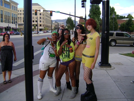
This is not exactly what my mental image was of Salt Lake City before the trip. Imagine my surprise to see this bunch of young girls walking down the street. I remarked to Justine that I'd love a picture of that, but was too embarrassed to ask. Never the shy one, Justine grabbed my camera and asked them if she could get a picture, which they graciously posed for. I like the shocked lady on the left.
Since I originally posted this blog entry I've been asked what the T gesture means in the above picture. I tend to think it is something besides "time out." If you know, please tell me.
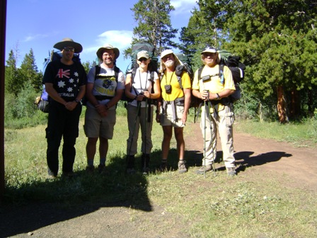
Emarking. From left to right: me, Joel, Justine, Harlan, Ali. Mental note: snapshots should be done in the shade or sun, not a mixture.
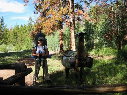
We encountered this llama near the trailhead. It has always bothered me when people pronounce llama with an L sound. In Spanish, and llama is a Spanish word, two L's are pronounced like a Y, as in tortilla.
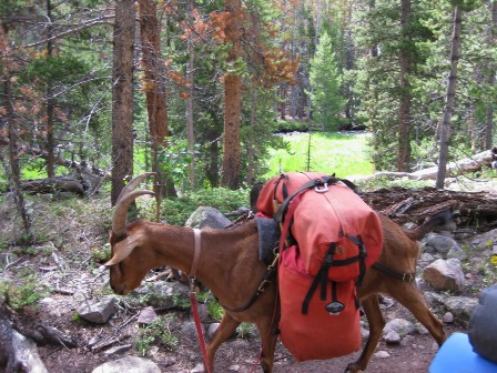
Some people used goats to lug their gear down the trail. One of them just stood there in the middle of the trail, and refused to budge, according to the guy who rented the goat. I guess there is some truth to the expression "stubborn like a goat."
This is a very ungraceful picture of me crossing the river.
Typical scene on the way to Dollar Lake. Kings Peak is off in the distance ? I keep forgetting which one.
We walked through a lot of mud like this. Sometimes it was much worse.
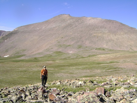
Justine, with Kings Peak in the background.
Starting to go up the rock pile.
Ubiquitous summit photo on Kings Peak. Harlan always does that yoga pose in summit photos.
This is the part of Gilbert Peak that Harlan compared to Scotland.
Summit of Gilbert Peak. The picture doesn't capture just how dang windy it was.
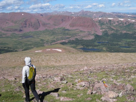
Looking down on Dollar Lake during the descent of Gilbert Peak.
On the way back to the car. Behind Justine and I is the first hurdle en route to Gilbert Peak. On the way down we couldn't remember our route up. Justine and I went the long easy way along the left side of the picture. Joel and Harlan went down the steep way, above Justine's head.
There are more pictures at the Las Vegas Mountaineering Club web site. This link will take you to Harlan's photos, some of which I used above (thanks Harlan!). The Utah pictures start with picture number 28.
Links
August 2010 Ascender newsletter, where this article also appears.


